Smarter territorial management

Make decisions with confidence and scientific evidence

ECOBASIN
Application screenshot

Everything you need for smarter territorial management

Use validated system dynamics models for water, nutrients and land use.

Territory modeling

Set up your area with GeoPackage, select modules and define inputs without coding.

Impact analysis

Assess water quality, nutrient flows, wastewater and land use with charts and Sankey diagrams.

Project management

Multiple runs, scenario comparison and mitigation measures in a single workflow.

Integrated visualization

Flow diagrams, territory maps and time-series results ready for reports and decisions.

One workspace that integrates model, data and results

Unify territory, variables and scenarios in a single collaborative environment.

ECOBASIN results
Your workspace screenshot
10K+Users
1M+Projects created
5XFaster
500+Territories modeled

Smarter territorial management in three steps

From setup to analysis, we guide you at every step.

Configure and define

Choose model and modules, upload your GeoPackage and set input variables for your region.

Run and explore

Run the model and explore results with charts, Sankeys and scenario comparison.

Decide and share

Test mitigation measures, export data and share the project with your team.

How teams use ECOBASIN to make better decisions

What territorial managers and planning teams are saying.

"ECOBASIN lets us compare land-use and treatment scenarios in minutes. Essential for reporting."

Planning teamWater administration

"Sankey diagrams and KPIs give us clarity when presenting results to policymakers and the public."

Environmental consultancyTerritorial projects

What you get with ECOBASIN

A full DSS loop: data → results → diagrams → multicriteria solutions — ready for papers and planning.

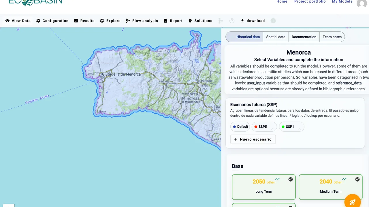
ECOBASIN View Data with map and variable panel

View Data — configure the territory

Upload geography, pick modules and fill inputs (past + SSP futures) without writing code.

  • GeoPackage map of your territory with spatial layers
  • Modules for wastewater, land use, aquifer, nutrients, energy, economy…
  • Historical points, SSP scenarios (Default / SSP1 / SSP5) and sensitivity bands
  • Public demos (e.g. Mar Menor) for exploration; your runs stay editable
View Mar Menor demo
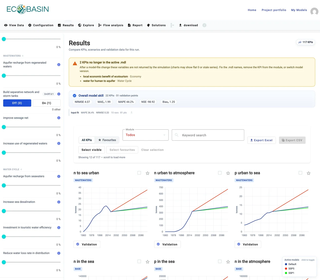
ECOBASIN Results KPI charts

Results — KPIs, validation and measures

Compare scenarios, check model skill against observations and preview management measures.

  • Time-series charts per KPI with Default / SSP1 / SSP5 overlays
  • Overall validation skill (NRMSE, MAPE, NSE…) and favourite KPIs
  • Side panel of management measures with Apply preview
  • Export Excel / CSV for reporting and further analysis
See public results
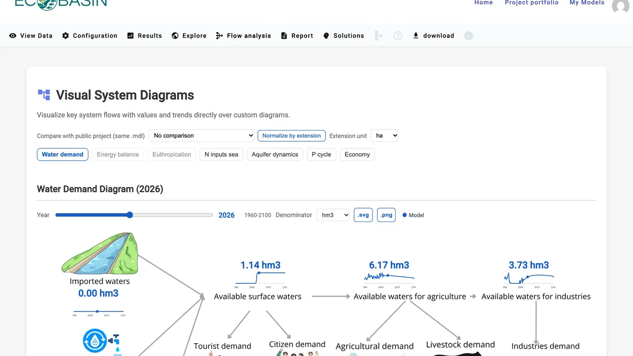
ECOBASIN flow / system diagrams

Flow analysis — system diagrams

Read stocks and flows on illustrated diagrams with live values and sparklines.

  • Water demand, aquifer dynamics, N inputs to sea, P cycle and more
  • Year slider (1960–2100) and unit / extension normalization
  • Compare against other public territories with the same model file
  • Download diagram as SVG or PNG for manuscripts
Explore diagrams
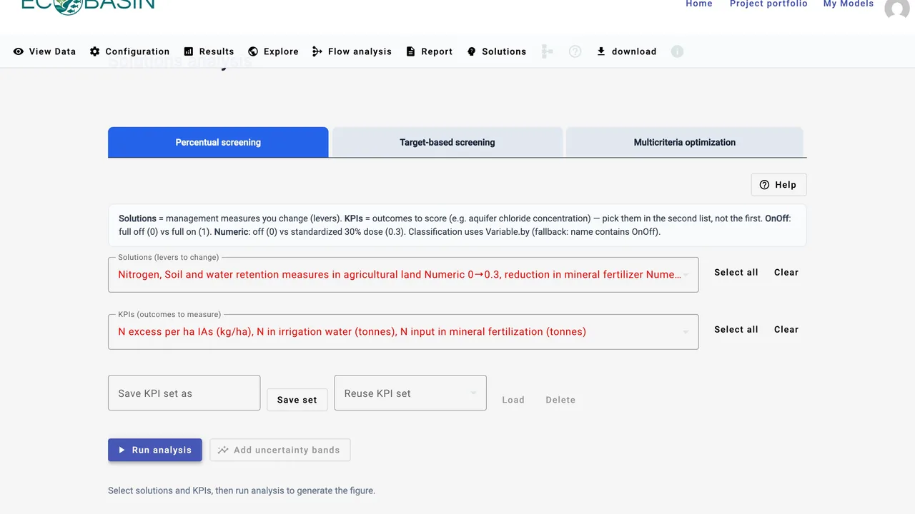
ECOBASIN Solutions and multicriteria optimization

Solutions — screening and multicriteria optima

Screen levers against KPIs, then run multicriteria optimization with importance weights.

  • Percentual and target-based screening of management measures
  • Multicriteria solver: direction, importance 1–5 and optional ceilings per KPI
  • Reuse KPI sets across SSP scenarios
  • Save and apply the optimum for a given SSP back into the run
Open Solutions

Smarter territorial management with ECOBASIN

Join teams already modeling and deciding with data.

ECOBASIN